In Shallow Water
How to take a sailboat where sailboats don’t usually go. Meaning, among other things, shallow water.
Station Creek to Harbor River
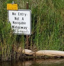
About 10 miles downriver from Beaufort, South Carolina, near the entrance to Port Royal Sound, is a small creek. At the entrance of that creek is a sign that says Not Navigable.
We could explain our desire to challenge authority and take Sunshine into the shallow water of that creek in a number of ways:
- Our preference is to avoid crowds. We opt for wilderness instead of society. This means we usually go at the wrong time, and often in the wrong direction.
- There’s a rumor that Station Creek once formed part of the original course of the Intracoastal Waterway (ICW). That would mean it once went somewhere. Intriguing.
- I’d been researching some history of the area for my next novel, Lowcountry Limbo, and learned that Harriet Tubman had worked as a spy in Beaufort. Tubman and company also raided the plantations near Combahee Ferry, about 32 nautical miles north of Beaufort. But I’d also learned that the northern channel of the Beaufort River wasn’t dredged until much later. How did they get the boats through? We wondered if they could have gone by way of Station Creek instead.
- Or we could keep it simple – We like to find out what’s around the next bend.
Finally, with a free few days, a boat running well, and no hurricanes in the forecast, we decided to try the trip up Station Creek. If all went well, we’d make our way out Harbor River and into St. Helena Sound. If it didn’t work out, we’d spend a few hours aground in a remote marsh, and when the tide came in, turn around, go back down the creek and explore somewhere else.
Station Creek

The entry to Station Creek is very narrow due to a sand bar building up along the river. You have to go downriver about half a mile past the creek mouth to get around the bar and find the way in. Local knowledge, baby!
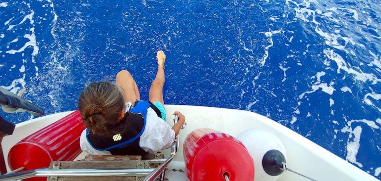
We’d anchored in the creek many times for an early morning departure on a trip out to sea. Once, we decided to dive to clean the propeller and the water intake. Luckily my mask broke before I jumped over the side because Tom caught the attention of the local wildlife. By which I mean, an alligator.
I armed myself with potatoes and scrub brushes to throw to distract the beast if it came too near. Everyone survived. This was before my announcement that I was going to learn to captain the vessel. I’m not sure I would go this far in my pursuit of adventure, or captain status. I might just leave the prop dirty.

Gator showing interest 
Gator deterents 
All parts still intact
We never wanted to go swimming at Station Creek again, but each time we visited, we still wondered what was beyond the next bend, and the next. We were about to find out.
Heading in just after low tide, we passed the anchorage, carefully rounded a couple of bends, and then found a spot of shallow water. I dropped anchor – working, once again, on my single-handing skills. We ate lunch, read books, studied the charts, and relaxed in the peaceful surroundings of a vacant marsh.
It’s always best to investigate iffy spots on a rising tide – not high tide! – because then you can always wait a bit, get unstuck, and retrace your path. We laid down a track using Navionics so we could see the safest route back.
Around a few more bends was a public boat launch, so we knew the creek was useable, at least some of the time, at least by small boats. What we didn’t know was whether a sailboat with a five-foot draft could make it through. Plus, there was a very narrow channel coming up. Going slow, and relying on that rising tide, we made it through the narrows. Then a party of fishermen went past, unconcerned about the lack of water. We waved at them, the way you do, and they waved back.
A few minutes later, the fishing boat came up behind and hailed us on the VHF radio. They said the water got really shallow up ahead, but that they could lead us through. I welcomed the help and they took the lead, hugging the right shore. I followed, leaving lots of space between us, just in case they got in shallower than we could manage.
Long story short, our guides got us to the boat launch, and then they gave us valuable information on which way to turn at the fork ahead. We thanked them, waved, and went on our careful way.
Trenchard’s Inlet
The creek eventually opened up into a wide and deep body of water called Trenchard’s Inlet. It runs between Pritchard’s Island which fronts the ocean, and St. Philip’s Island and Capers Island, which lay behind the barrier islands.
We explored a couple of meandering creeks off the inlet looking for an anchorage for the night. Funny thing, after all that shallow water we found when we wanted to move the boat, we could only find extremely deep water when we wanted to keep the boat in once place for the night. We settled for about 18 feet in a creek behind Fripp Island and settled in to watch the sunset.
In the morning we headed down Trenchard’s toward the inlet to see if we could find a way to walk on the beach. We weren’t trying to get out to sea. As far as a sailboat goes, Trenchard’s is an inlet in name only. Water can get in and out, but we can’t.
The other thing that can get in is sea life. We were motoring along, no camera at the ready, unfortunately, looking out toward the shore, when a huge leatherback sea turtle came up for air. Its entire back came out of the water, twice. And what a back! Just wow! It looked like it was welded and riveted together out of steel plates, what an incredible creature.
St Phillip’s Island
Until recently, this island was owned by Ted Turner. After Hurricane Matthew, he gave it to the state, and it’s now a park. We hadn’t heard that news yet when we were there or we would have dinghied over to take a walk. Instead, we took our beach walk across the way, on Bull Point.
Bull Point, Pritchard’s Island


We anchored behind the tip of Pritchard’s Island just after low tide. Not to belabor the point, but we didn’t want any chance at all of Sunshine’s anchor breaking loose and her drifting in the direction of the opening. The rising tide is our friend.
The rising tide is a boater’s friend, but maybe not so much the beachfront homeowner’s friend. Pritchard’s Island is all but uninhabited. The two or three houses out there seem to have been left for the sea. Structures that are not all that old have been demolished by storms and encroaching waves.
Old House Creek
For lunch, we pulled into the creek that runs between deserted Old Island and Fripp Island. Fripp is a gated community, off-limits to rank and file Beaufort citizens.
I’ve always thought the presence of a gate must mean that Fripp was a really special place. but our trip up the creek showed us non-descript houses sided in T-111 and a waterfront restaurant closed and rotting into the marsh. The creek was a great place to drop the hook for lunch and paddle around in kayaks.
Behind Hunting Island
The next night we anchored behind Hunting Island State Park, in what is actually the middle of the Harbor River. What it looked like though was a creek. Along a tidal coast, it can be hard to tell a river from a creek from an inlet from a puddle. There is just water everywhere. But the depth matters. No matter how narrow or shallow, all the watery channels we found in the area were marked as part of the river.
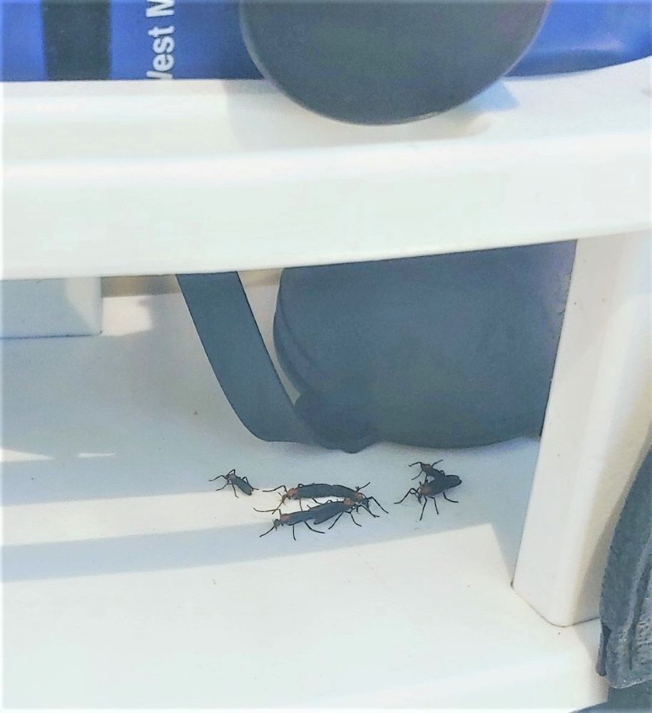
And all the creeks were also swarming with love bugs. They don’t bother us, they don’t bite or sting. They just fly around, ahem, joined.

Heading out the Harbor River
Do I need to say it again? Rising tide, rising tide, rising tide.
The Harbor River is shallow and filled with hummocks of oysters. Though not as hard as rock, shells can scrape up the ole paint job. I got distracted, misread the chart, and turned too sharply. Cur-runch! I felt like a total fool. But the tide lifted us a few minutes later. I assigned the task of getting us off the bar to my second in command. Tom soon had us in deeper water and headed toward the bridge.
Harbor River Bridge

This charming little old bridge is an adventure all it’s own. Even driving across it makes the heart race. The lanes are so narrow it feels like one lane, especially when a large vehicle or a truck towing a boat is coming the other way. It opens a couple of times a day to let a shrimp boat in or out. No one but a crazy person ever takes a sailboat under it.
We hailed the bridge to ask for an opening. Someone hailed us back, and either we had a bad connection, his dentures were loose, or we’d woken him out of a deep sleep. We were totally unable to understand him.
On the third try, we finally got the message that he’d open as soon as we were at the bridge. There’s little traffic on the road, so the bridge opens on demand and we made it through while the tide was still coming in. Which was definitely needed for navigating the next place sailboats don’t go.
Egg Bank
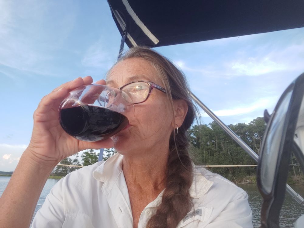
Since I’d just run us aground in the calm shallow water of the Harbor River, I was not up for tempting fate. It was getting late. The tide was almost high. A storm was brewing on the northern horizon and the seas were hectic.
I generously let Tom keep the wheel for the transit of Egg Bank, the narrow cut that would take us from Harbor River to Morgan River without going all the way out into the open sea.


The Egg Bank cut runs north-south between two submerged sand bars – AKA the Bank. We’d heard stories of scofflaw fishermen, chased by law enforcement, racing through the cut, hoping to wreck their pursuers on the bar. That relentless, rising tide sent rollers at us, and Sunshine rocked uncomfortably side to side.
I poured myself a glass of wine and went to the bow where I could more efficiently worry about how deep the water in front of us was, and whether the waves would push us up on the bank.
Morgan River
Tom muscled us through and with a sigh of relief, we turned into the deep Morgan, which would take us to our anchorage for the night. Sunshine lazily surfed the big rollers now coming at her stern. I took the wheel again and eased the frown line out from between my brows. I like this adventure shit, right? It’s so much better when you feel just a tiny bit in control.
Eddings Creek
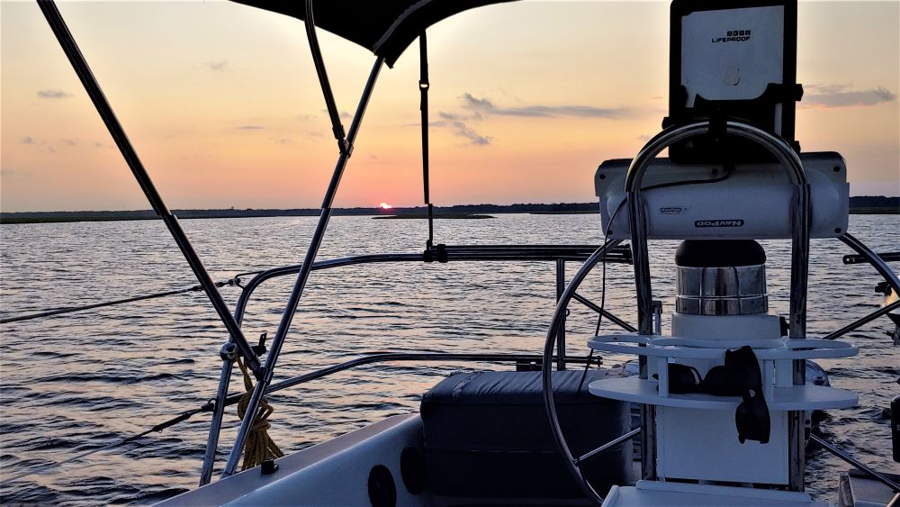
At anchor between a small, forested island and a marsh, we wound down with wine and sunset, going back over the sticky situations we’d faced that day. I tried not to dwell on the memory of running us aground. The scenery helped. Maxfield Parrish could have painted the thunderheads of the passing storm. A deer came out of the forest, swam across the creek, and disappeared into the marsh without rippling the grass. To perfect the scene, Dolphins fished for their dinner where the two creeks met, just beyond Sunshine’s bow.


In the morning we wound back up again with coffee, then I hauled anchor and pointed Sunshine up the Morgan to start the run back to the marina.
More shallow water exploration for another day.
Admission time.
Since this route took us three days, we now know it’s unlikely Harriet Tubman and her raiding party went this way to reach Combahee Ferry. Though I’ve not been able to find a description of the complete route, up Beaufort River is the only other option, so I’m accepting that’s the way they went.
Bartlett’s Familiar Laws of Boating says:
Always keep a spare adventure on tap for another day.
The question of whether we can follow the rest of that route remains.
From the Morgan, to the Coosaw, up the Combahee to the historic site of Combahee Ferry is about 16 miles. About half of that shows depths we can navigate, then the chart cuts off, going from 32 feet to an unknown depth. Could be shallow water.
We know for sure we can’t get past the low bridge that now sits where the ferry was in Tubman’s day. But we might be able to anchor downstream of the bridge, hop in the dinghy and explore the site of that famous raid that was instrumental in turning the tide of the Civil War.
Not knowing what the day will hold is always the best part of the adventure. Sure, some parts can be hair-raising, but we always learn something.
News

Books
Paperback versions of all three Iris Winterbek Adventures have arrived! I’m so excited to see them in physical form, shown here with other tools and artifacts of adventure.
You can get your own set on Amazon. There may still be a delay in shipping, due to books being considered “non-essential.” Ha! Books are essential.
Boat
Sunshine is getting a lovely new headliner (AKA ceiling) and lights. Tom also refinished all the teak trim. It looks gorgeous.

Reading
Like many of you, I’ve been consumed recently with thoughts of justice. I’ve read How to Be an Anti-Racist, by Ibram X. Kendi, and White Fragility , by Robin DiAngelo, and am enjoying the painful process of learning about the ways racism is embedded in my life and what to do about it. These books were wonderful and I recommend them.
My next novel Lowcountry Limbo, deals with some effects of racism and I’m working to make sure I cover the topic fairly and accurately.
Do you have other books about racism that you’d recommend? Let me know in the comments.
The Future
Summer plans include more boat improvements and the publication of my next book.
We’re scrambling to get a lot done with the idea of heading north, out of the path of hurricanes for a little while. Along with exploring more shallow water, we also want to see some of the areas of the ICW that we’ve only seen under a coating of snow and ice during our Escape from New England.